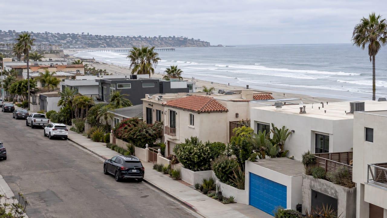
San Diego's tsunami risk is real but infrequent, and it is mapped street by street. Most of the county's mapped hazard area sits along low-lying coastline, bays and harbors, so the question for a buyer or seller is not "is San Diego safe?" but "is this particular address inside the official zone, and what do I do about it?" You can answer that in about five minutes with a free county tool, and a local agent who knows the neighborhoods can help you fold the answer into your search, your offer or your listing.
TL;DR
- Tsunamis that reach San Diego come mostly from distant earthquakes (Alaska, Japan, Chile), which give hours of warning. Local sources are rarer and leave only minutes.
- The state's 2022 hazard area map covers coastal communities including Del Mar, La Jolla, Point Loma, Imperial Beach and National City. The City of San Diego's evacuation map also shows red zones in Pacific Beach, Mission Bay and Ocean Beach.
- Type any address into the county's free Know Your Hazards tool to see whether it is inside a zone.
- Areas under 25 feet above sea level and within about a mile of the shoreline face the greatest risk, according to UC San Diego.
- Whatever the zone, register for AlertSanDiego and know your route to higher ground before you close.
Table of Contents
- Where San Diego's tsunami risk comes from
- Which San Diego neighborhoods are in tsunami zones
- How far inland a tsunami could reach
- How to check a specific address
- What changed with the 2022 maps
- Understanding alerts: warning, advisory, watch
- If you are buying: build it into the search
- If you are selling: get ahead of the question
- Working with us on a coastal purchase or sale
- Our perspective
- FAQ
- Sources
Where San Diego's tsunami risk comes from
Tsunamis that affect San Diego fall into two groups, and they behave very differently.
Distant (remote) tsunamis start at earthquakes far across the Pacific. According to AlertSanDiego, the county's emergency alert program, remote tsunamis have been the most frequent to hit California, generated by earthquakes off Japan, Alaska, Hawaii and Chile. The largest on record for Southern California came from the 1960 Chile earthquake (magnitude 9.5), which produced 4-foot waves at Santa Monica and Port Hueneme and did major damage to the Los Angeles and Long Beach harbors.
Because these waves take hours to cross the ocean, warning centers have time to alert emergency personnel. UC San Diego's safety guidance adds that ocean depth and the islands of the Southern California borderlands act as a natural baffle to remote waves.
Local (near-field) tsunamis come from faults or underwater landslides close to shore. The same AlertSanDiego page says only four locally generated tsunamis have been observed off Southern California since 1800, the most significant in 1812, with 6- to 10-foot waves in Santa Barbara and Ventura counties. The catch is time: UC San Diego says the first wave from a nearby event could reach the beach within minutes, with little warning.

The state's 2009 inundation mapping modeled both groups. The California Geological Survey (CGS) map for the San Onofre Bluff area lists local sources such as the Coronado Bank Fault, the San Clemente Fault and the Coronado Canyon landslide, plus distant sources including the 1960 Chile, 1964 Alaska and Cascadia subduction zones. Its inundation line is a maximum considered runup, and the survey notes actual flooding in a major event could be greater.
What recent events looked like
Most residents have only seen the mild version. After the February 2010 Chile earthquake (magnitude 8.8), the City of San Diego reports that waves arrived in the afternoon and caused rapid tidal drawdowns, surges and unusual currents, but no significant flooding or damage. In July 2025, after a magnitude 8.7 earthquake in Russia, USA Today reported that San Diego County was placed in a tsunami advisory. The National Weather Service said not to expect widespread inundation but to stay off beaches and out of harbors and marinas.
That is the typical pattern: an alert, strong currents near the water, and a few hours of staying away from the shore.
Which San Diego neighborhoods are in tsunami zones
There are two official maps you will hear about, and they serve different purposes.
The state hazard area map. The 2022 CGS Tsunami Hazard Area Map for San Diego County covers Del Mar, Encinitas, Imperial Beach, La Jolla, National City, Oceanside/San Luis Rey, Point Loma and San Onofre Bluff. It is built for local coastal hazard planning. CGS states it is not a legal document and does not meet disclosure requirements for real estate transactions, so treat it as the planning picture rather than a paperwork substitute.
The City of San Diego evacuation map. AlertSanDiego's city evacuation map shows red tsunami zones based on the state maps. It covers Point Loma, La Jolla, Pacific Beach, Mission Bay, Ocean Beach, Sunset Cliffs, Torrey Pines and the harbor area. The instruction on the map is simple: people outside the red zone do not need to evacuate, and after an earthquake you go to the safe area.
The county built evacuation maps for each coastal city using the state's inundation data, with common terminology and symbols along San Diego's 70 miles of coastline. City-specific brochures went to every residential and business address in the worst-case zone.

What this means for common buyer searches
If you are drawn to the beach, you will meet these maps quickly. Mission Beach, Pacific Beach, Ocean Beach, Point Loma, Coronado and the bayfront areas are all low-lying, and many of them are within or near mapped zones. A zone is not a reason to rule a neighborhood out. It is a reason to know the facts for the exact street.
If you want a closer look at the lifestyle side, our guides to beach communities in San Diego, Point Loma real estate and buying a beach-area second home in Mission Beach show how each area lives day to day.
How far inland a tsunami could reach
The elevation and distance rules are easy to remember. UC San Diego says areas less than 25 feet above sea level and within a mile of the shoreline are at greatest risk, and maximum runups from nearby events are predicted at roughly 20 feet or less.
Fox 5 San Diego reports that most tsunamis worldwide are under 10 feet, that 13 tsunamis in the past 150 years were large enough to cause damage in San Diego County, and that it is very rare for one to travel more than a mile inland. It also makes a point that matters for planning: the first surge is usually not the highest, and the largest wave may come hours later. That is why the all-clear, not the first quiet minutes, is the signal to go back.
In practice, three things set how far water goes:
- Elevation of the lot. A bluff-top home and a bayfront home a few blocks apart sit in very different positions.
- Distance and the shape of the shoreline. Bays, harbors and river mouths funnel water differently than open beach.
- The source. A distant tsunami arrives weakened by the open ocean and the offshore islands, while a local one arrives fast.
How to check a specific address
This is the part most buyers and sellers actually need. Here is the routine.
- Run the address through the county tool. San Diego County's free Know Your Hazards mapping tool lets you enter a home or business address and see a layered map of wildfire, earthquake, flood and tsunami risk. Run it on every home on your shortlist, and on your own home before you list.
- Cross-check with the state tool. Cal OES says anyone can check personal risk by entering an address in its My Hazards tool. The yellow hazard area on the state map represents the maximum considered runup from several extreme, infrequent and realistic sources.
- Read the zone as a planning envelope. The mapped area is not a forecast of one event. CGS says the boundaries were extended to include credible local scenarios and adjusted to line up with geographic features or city streets, so a property just outside a line is not automatically unaffected, and one just inside will not necessarily flood.
- Check the neighbors in the same file. Tsunami, flood, earthquake and fire layers appear on the same county map. For a coastal purchase, our guides to flood zone maps, earthquake fault zone maps and fire zones explain the other layers.
- Use the official disclosure paperwork for the transaction. Because the CGS map itself is not a disclosure document, rely on the formal disclosure process in your purchase contract, and ask your agent to walk through what it says about the property.
The tool tells you whether an address is inside a zone. It does not tell you how a given neighborhood compares on price, commute, lot elevation or resale. That is where local knowledge earns its keep.
What changed with the 2022 maps
The current maps are newer than most older articles on this topic. CGS dated the San Diego County map October 7, 2022. It builds on the 2009 inundation maps and adds high-resolution probabilistic modeling with a 975-year return period (a 5% chance of being exceeded in 50 years). The refinement used 1-meter LiDAR elevation data, recent aerial imagery and fieldwork with local county staff.
Per the California Department of Conservation's 2022 announcement, the new maps use a magnitude 9.3 earthquake in the eastern Aleutian Islands as the worst-case distant source, account for potential local sources in most counties, and come with updated local kiosks and signage through Cal OES. NBC 7 San Diego reported that San Diego was one of seven counties with updated interactive maps at that time.
If you remember a zone boundary from years ago, check the current one. The line may have moved.
Understanding alerts: warning, advisory, watch
The National Weather Service uses four alert levels, and the differences affect what you do:
| Alert | What it means | What to do |
|---|---|---|
| Tsunami Warning | Widespread flooding may occur | Evacuation is recommended for the zone |
| Tsunami Advisory | Dangerous currents or waves may occur near the water | Stay out of the water and away from beaches and waterways |
| Tsunami Watch | A tsunami is possible | Stay alert for updates |
| Tsunami Information Statement | Generally no threat, or threat not yet determined | No action needed |
The NWS also says natural signs are a warning to act without waiting: a strong or long earthquake, a sudden rise or fall of the ocean, or a loud roar from the sea. UC San Diego notes that within the Alaska-based West Coast warning center's area, a warning goes out within 15 minutes of any coastal earthquake of magnitude 7.1 or greater, and television, radio and local law enforcement then direct evacuation in warned areas.
A short household plan
San Diego County's News Center recommends you register for AlertSanDiego, complete a Personal Disaster Plan, download the Genasys Protect app and be ready to leave in 15 minutes or less. Add to that the steps Fox 5 San Diego draws from state emergency guidance:
- If you are in the evacuation area and feel a strong earthquake, move to higher ground right away without waiting for an official warning.
- Stay on higher ground until the all-clear.
- If you are outside the hazard zone, stay where you are.
- If you have no map or signs, head one to two miles inland or to higher ground.
- If you are on a boat in the harbor, leave the boat and go to high ground.
Boat owners should read the National Weather Service boater guidance. It says that in 30 fathoms (180 feet) of water you are safe from tsunamis, and that for most California harbors, which are relatively small, it is safer to keep a boat docked during a tsunami. If you feel a natural warning, leave the boat and go to high ground on foot.
If you are buying: build it into the search
A tsunami zone check belongs in the same pass as price, school, commute and condition. A practical order:
- Decide your comfort level before you tour. Some buyers want the beach and are comfortable with a mapped zone and a plan. Others prefer to be outside it. Either is a valid choice, and knowing which one you are narrows the search quickly.
- Filter by address, not by neighborhood name. Zones follow elevation and streets. Two homes in Point Loma or La Jolla can sit on opposite sides of the line.
- Check every shortlisted address in the county tool and write down the result next to the listing.
- Look at the whole hazard picture. Coastal homes often raise earthquake questions too. Our guides on earthquake insurance and earthquake retrofits cover the next questions to ask.
- Ask about insurance early. Talk to your insurance agent or lender about what coverage applies to the specific address before you remove contingencies, so nothing about the property surprises you in escrow.
- Learn the route out. On your second visit, walk or drive the way to higher ground and note the evacuation signs.
New to the area or arriving on orders? Our guide to relocating to San Diego on military orders covers neighborhood basics, and the 2026 home buying and selling guide lays out the full process.
If you are selling: get ahead of the question
If your home is near the coast or the bay, expect buyers to ask. Prepared sellers make that conversation easy.
- Look up your own address first in the county tool so you know the answer before anyone asks.
- Gather the facts: your elevation relative to the zone line, the evacuation route, and the alerts you are signed up for.
- Price with the neighborhood, not the headline. Coastal buyers in San Diego already know the area sits beside the ocean, and a local market analysis shows how comparable homes nearby have actually sold.
- Present the home's strengths: the location, the lifestyle and the preparedness that goes with it.
A clear, calm answer to the tsunami question tends to keep a buyer's attention on the home itself.
Working with us on a coastal purchase or sale
If you are weighing a San Diego home near the water, our Buy With Confidence service gives buyers personalized guidance from the first showing through closing, and our VIP Home Search delivers personalized listings for the neighborhoods and cities you choose. Selling? Sell With Strategy pairs strategic marketing with strong negotiation, and a home valuation starts with a localized market analysis of your neighborhood.
Tell us the areas you are considering and we will build the search around them.
Our perspective
Over two decades of working in San Diego, I have seen that buyers who ask about tsunami risk are usually asking a bigger question: can I live here with peace of mind? The answer starts with facts, and the facts are well documented. The zones are mapped, the alerts are clear, and the plan fits on a single page.
What I care about is that you make the decision calmly and early, not in the last days of escrow. We look at the location you love, check the address against the official maps, and keep the search focused on homes that fit how you want to live. For sellers, the same approach works in reverse: know your address, know your market, and present your home with confidence.
My job is to stay with you from the first showing to closing, with calm, precise support and availability when you need it. A coastline is part of what makes San Diego special, and with the right preparation it is a very good place to call home.
Jeff
FAQ
Is San Diego at high risk for tsunamis?
San Diego's risk is real but infrequent. Most events are distant tsunamis that bring warning time and, in recent cases, strong currents rather than flooding. Local sources are rarer and give far less notice, which is why the mapped zones and personal plans matter.
How do I know if a house is in a San Diego tsunami zone?
Enter the address into San Diego County's free Know Your Hazards tool, which shows tsunami, flood, earthquake and wildfire layers. You can cross-check with the state's My Hazards tool. The City of San Diego's red evacuation zones are based on the state's maps.
How far inland can a tsunami go in San Diego?
UC San Diego puts the greatest risk at areas under 25 feet above sea level and within about a mile of the shoreline. Fox 5 San Diego reports it is very rare for a tsunami to travel more than a mile inland. Your own address and its elevation decide the real answer.
Does San Diego have a tsunami warning system?
Yes. The National Weather Service issues warnings, advisories and watches, and the county's AlertSanDiego system sends local notifications. Register for AlertSanDiego and download the Genasys Protect app so alerts reach you quickly.
Should a tsunami zone change how I price or shop for a home?
It should inform the decision, the way flood, fire and earthquake layers do. Check the address, understand the zone line, and compare nearby homes that have actually sold. A local agent can run that comparison with you.
Sources
- AlertSanDiego: Tsunami
- CGS Tsunami Inundation Map, San Onofre Bluff Quadrangle (2009)
- City of San Diego: Tsunami Awareness and Preparedness
- USA Today: Tsunami evacuation orders lifted in Hawaii, threat to West Coast
- UC San Diego: Tsunamis and Southern California
- CGS Tsunami Hazard Area for San Diego County (2022)
- AlertSanDiego: City of San Diego tsunami evacuation map
- Fox 5 San Diego: San Diego tsunami evacuation signs
- County of San Diego News Center: Find Your Home's Hazard Risks
- Cal OES: Tsunami Risk
- California Department of Conservation: California Completes Its Coastal Mapping of Tsunami Risk
- NBC 7 San Diego: Where Is Your House on New California Tsunami Map?
- National Weather Service: Understanding Tsunami Alerts
- National Weather Service: Tsunamis! What Boaters Should Know