
Check your address on FEMA's Flood Map Service Center and cross-reference it against the City of San Diego's flood mapping page and San Diego County's supplemental flood maps. If your address falls inside a Special Flood Hazard Area, get a flood insurance quote and ask about an elevation certificate before you close. FEMA's maps are probability models, not guarantees, and 2026 revisions have already shifted some boundaries in San Diego County.
TL;DR:
- San Diego's flood maps are probability models that can change significantly with the upcoming 2026 revisions, affecting boundary and elevation designations.
- The FEMA flood zone codes indicate statistical flood likelihood, with Zone VE and floodways imposing the strictest construction and elevation requirements.
- Flood risk varies greatly within neighborhoods like Mission Valley, Southcrest, and Tijuana River Valley, where infrastructure age and cross-border issues increase flood exposure.
- Homeowners and buyers should prioritize verifying current maps, requesting elevation certificates, and considering flood insurance even outside high-risk zones.
- Local floodplain management standards often surpass FEMA's requirements, especially in unincorporated areas, making early permit review crucial for construction or renovations.
Table of Contents
- Where to Find Official Flood Maps for San Diego Properties
- What FEMA Flood Zone Codes Actually Mean
- San Diego Neighborhoods Known for Flood Risk
- Flood Insurance, Map Changes, and the LOMC Process
- Practical Flood Preparedness Steps for San Diego Homeowners
- Buyer and Seller Checklist for Flood-Zone Properties
- Historical Flooding in San Diego and Why the Pattern Repeats
- How San Diego Building Codes Handle Flood-Prone Land
- Climate Change Is Already Reshaping San Diego's Flood Maps
- Flood Zones and Their Effect on San Diego Home Values and Sales
- Why Maps Are a Starting Point, Not the Final Word
- How Jeff Can Help You Navigate a Flood-Zone Property
- Where to Check San Diego Flood Maps: Quick Reference
- Sources
- FAQ
Where to Find Official Flood Maps for San Diego Properties
Three sources matter, and each fills a different gap.
Start with FEMA's Flood Map Service Center. Type in the property address, and the tool generates a FIRMette, a printable snapshot of the official Flood Insurance Rate Map for that parcel. It shows the zone designation, the map panel number, and the effective date, which you'll want later if you're disputing a lender's flood determination.
The City of San Diego's flood page layers local context on top of FEMA data. It explains how the city participates in the National Flood Insurance Program and the Community Rating System, and it points residents back to FEMA's MSC for the authoritative map itself rather than duplicating it.
San Diego County goes further for unincorporated areas. County engineers have mapped floodplains along waterways FEMA hasn't formally studied, and those county maps get used alongside FEMA FIRMs in permitting decisions.
For the most granular view, use SanGIS, the joint city-county GIS platform. Its map service exposes the raw data behind the FIRM, including:
- FLD_ZONE (the exact zone code for a parcel)
- STATIC_BFE (base flood elevation in feet)
- FLOODWAY (whether the parcel sits inside a regulated floodway)
Pro Tip: Screenshot or save the FIRMette PDF, not just a map screenshot. It includes the panel number and effective date, which insurance underwriters and lenders often require as proof.
What FEMA Flood Zone Codes Actually Mean
Every FEMA flood zone label corresponds to a statistical flood probability, not a flood forecast.
Zone VE applies to coastal areas facing storm-wave action and carries stricter elevation and construction rules than AE.
A floodway is the channel and adjacent land that must stay clear to carry floodwater without raising elevations elsewhere. Building in a mapped floodway triggers the tightest restrictions of any zone category. When San Diego County's supplemental maps impose stricter limits than the FEMA FIRM for the same parcel, the county's own guidance confirms the more restrictive standard governs.
San Diego Neighborhoods Known for Flood Risk
Certain San Diego communities show up again and again in city reporting and county flood studies, and the reasons differ block to block.
- Mission Valley sits in the San Diego River floodplain, and its low elevation combined with dense development along the river channel makes it one of the city's most persistently mapped SFHAs.
- Chollas Valley and Southcrest deal with aging storm drain infrastructure; heavy rain overwhelms culverts faster than the pipes can move water out, a pattern local reporting tied directly to 2024 storm damage.
- Sorrento Valley floods where Carroll Canyon Creek and the rail corridor constrict water flow during heavy runoff from surrounding mesas.
- Tijuana River Valley faces cross-border flow issues, seasonal storm surges, and sediment buildup that regularly pushes water outside the channel.
- Otay Mesa sees flash flooding tied to rapid runoff from undeveloped mesa terrain feeding into smaller drainage systems not built for peak volume.
FEMA's 2026 map update effort for San Diego County has revised elevations and boundaries along several of these waterways, which means a parcel that sat in Zone X two years ago could now show up inside an SFHA, or vice versa. Always confirm the current effective date on any map product before relying on it.
Flood Insurance, Map Changes, and the LOMC Process
If a lender's flood determination places your property in an SFHA, mortgage requirements almost always mandate flood insurance through the National Flood Insurance Program, and premiums are priced against the mapped zone and BFE.
The City of San Diego's participation in the Community Rating System gives residents a modest premium discount tied to the city's floodplain management practices, so ask your insurance agent whether the CRS discount applies to your policy before assuming standard NFIP rates.
Even properties outside mapped high-risk zones carry real exposure. FEMA's own guidance notes that homeowners in moderate- or low-risk zones are still statistically more likely to experience a flood than a fire over a 30-year span, which is worth remembering if you're tempted to skip coverage just because you sit in Zone X.
If you believe the map is wrong for your specific lot, you can request a Letter of Map Change:
- Order a licensed elevation survey confirming your lowest floor elevation relative to the mapped BFE.
- Submit the elevation certificate and supporting survey data through FEMA's online LOMC portal.
- Wait for FEMA's review, which typically takes several weeks to a few months depending on documentation completeness.
- If approved, keep the LOMA or LOMR on file. It can remove a mandatory insurance requirement and lowers future disclosure friction when you sell.
Practical Flood Preparedness Steps for San Diego Homeowners
Maps tell you the odds. Preparation determines what happens when the odds catch up with you.
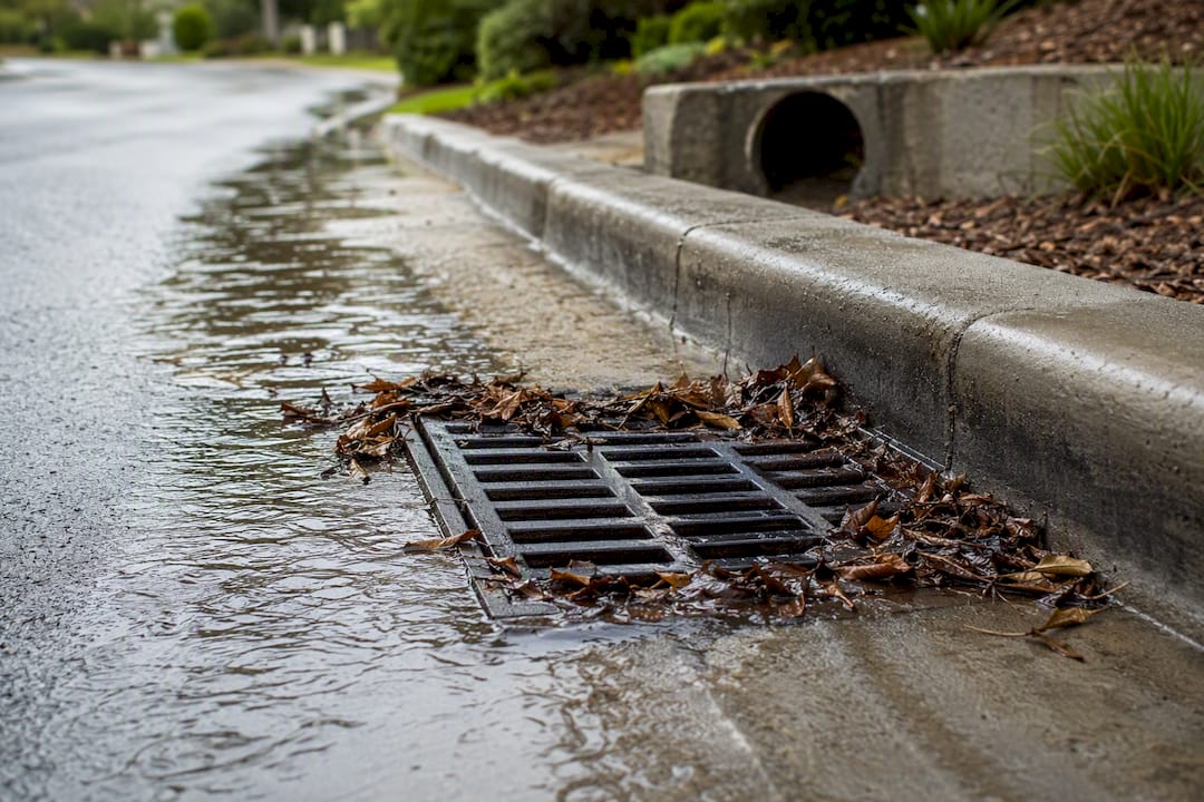
- Keep gutters, yard drains, and street-facing culverts clear year-round, not just before a forecasted storm.
- Ask a licensed contractor whether flood vents are permitted for your foundation type; they let water pass through a crawl space instead of pooling against it.
- Keep sandbags or a modern flood-barrier alternative on hand if you're in or near a mapped SFHA.
- Store elevation certificates, past claims history, and insurance documents somewhere you can grab them in a rushed evacuation.
- Know your evacuation route before the storm hits. Mission Valley and river-adjacent roads flood fastest and close first.
Pro Tip: Photograph high-water marks on your property immediately after any flood event. Documentation gathered right after a storm carries far more weight with insurers than a description written weeks later.
Report clogged storm drains or damaged culverts directly to city or county public works. Deferred maintenance is one of the drivers behind repeated flooding in older neighborhoods, and reporting it is the fastest way to get it queued for repair.
Buyer and Seller Checklist for Flood-Zone Properties
If you're buying near a mapped boundary, pull the FIRMette yourself, request the seller's elevation certificate, and get an insurance quote before you're locked into a contract. Ask your inspector to look closely at grading and drainage, not just the roof and foundation.
Sellers should assemble any elevation certificate on file, disclose past flood claims honestly, and document completed mitigation work. A well-documented file often speeds up a buyer's insurance underwriting and reduces last-minute renegotiation over flood risk.
Historical Flooding in San Diego and Why the Pattern Repeats
San Diego doesn't flood the way the Midwest or Gulf Coast does, in slow, sustained river swells. It floods in sudden bursts when intense rain overwhelms a drainage system built for a drier climate.
The most damaging recent example came during the storms tied to El Niño patterns, when neighborhoods including Southcrest and parts of Mission Valley experienced significant flooding as culverts clogged and aging storm drains couldn't keep pace with runoff. Residents and reporting after those storms pointed to the same root causes repeatedly: deferred infrastructure maintenance, undersized pipes in older neighborhoods, and creek channels that hadn't been cleared in years.
That pattern matters for anyone reading a flood map today. A parcel can sit in Zone X on paper and still take on water during an extreme rainfall event, because FEMA's mapped zones model statistical probability based on historical data and engineering studies, not every possible storm scenario. San Diego's drainage infrastructure age varies wildly block to block, and a 1960s storm drain system serving a hillside neighborhood behaves very differently than a modern system in a newer development.
This is also why city and county planners keep revisiting the maps. Every major flood event generates new hydrology data, and that data eventually feeds into FEMA's next round of map revisions for the county. The 2026 update cycle reflects exactly that process: engineers re-examining waterways that behaved differently than older models predicted, then adjusting boundaries and elevations accordingly.
How San Diego Building Codes Handle Flood-Prone Land
Development inside a mapped Special Flood Hazard Area in San Diego runs through a stricter permitting track than a standard build.
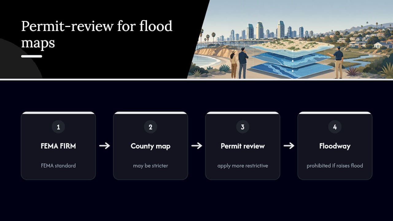
Any new construction or substantial improvement inside an SFHA must meet elevation requirements tied to the Base Flood Elevation for that parcel, meaning the lowest floor typically has to sit at or above the BFE plus any local freeboard requirement. Floodway parcels face the tightest limits of all: development that would raise flood elevations elsewhere is generally prohibited outright, regardless of elevation.
Where county flood maps impose stricter standards than the FEMA FIRM covering the same parcel, county building and planning staff apply the more restrictive standard during permit review. That detail catches a lot of property owners off guard, especially in unincorporated areas where county maps cover waterways FEMA hasn't formally studied.
Renovation projects matter here too. A "substantial improvement," generally a renovation whose cost exceeds a set percentage of the structure's market value, can trigger the same elevation and flood-vent requirements as new construction, even on a decades-old house that predates current flood maps. That's a common surprise for owners planning a major remodel on an older Mission Valley or Sorrento Valley property who assumed grandfathered status would protect them indefinitely.
Anyone planning new construction, an addition, or a major remodel inside a mapped SFHA should pull permit requirements from the city or county building department early, before finalizing architectural plans.
Climate Change Is Already Reshaping San Diego's Flood Maps
Flood zones aren't static lines drawn once and forgotten. They shift as rainfall patterns, sea levels, and storm intensity change, and San Diego is seeing that shift play out in real time.
Warmer air holds more moisture, which tends to produce heavier, more concentrated rainfall during storm events even if total annual rainfall doesn't change much. That's part of why intense short-duration storms have overwhelmed drainage systems in neighborhoods that historically saw manageable runoff. Sea level rise adds a second pressure point for coastal and low-lying areas, pushing tidal influence further inland along waterways like the San Diego River and the Tijuana River Valley and complicating how quickly floodwater can drain during a storm that coincides with high tide.
FEMA's ongoing map revision process for San Diego County is, in part, a response to this shifting baseline. Engineering studies conducted today incorporate more recent rainfall and runoff data than studies from a decade or two ago, and that newer data is exactly what's driving boundary and elevation changes in the 2026 update cycle. A property that was comfortably in Zone X under an older FIRM may find itself reclassified as the underlying hydrology models catch up with current conditions.
For homeowners, the practical takeaway isn't panic, it's monitoring. Map boundaries near your property aren't guaranteed to stay put for the life of your mortgage, and checking the effective date on your flood map product periodically is a cheap habit that avoids an unpleasant surprise at renewal or resale.
Flood Zones and Their Effect on San Diego Home Values and Sales
A flood zone designation doesn't automatically tank a property's value, but it does change the transaction.
The most immediate effect is mandatory insurance. A buyer financing a purchase inside an SFHA will be required by their lender to carry flood insurance, and that added annual cost gets factored into their overall affordability calculation the same way property taxes and HOA dues do. On a marginal deal, that added expense can shift a buyer's offer down or push them toward negotiating repairs and mitigation credits.
Disclosure obligations add friction too. Sellers of flood-zone property need to be upfront about past flood events, insurance claims history, and any mitigation work completed, and buyers should treat flood-related disclosures as seriously as they'd treat a foundation issue. A property with a documented claims history and no visible mitigation tends to draw more scrutiny during inspection negotiations than one where the seller can show completed drainage improvements or an elevation certificate confirming the structure sits above BFE.
That said, flood zone status rarely kills a deal outright in a market as competitive as San Diego's. Well-informed buyers who understand the insurance math, and sellers who document mitigation honestly, generally still close transactions in these areas, just with a more detailed paper trail than a comparable sale outside a mapped zone.
Why Maps Are a Starting Point, Not the Final Word
Every map on this list tells you what a probability model says about a parcel. None of them tell you whether the yard actually drains, whether a neighbor's grading sends water toward your foundation, or whether a culvert down the block has been cleared this decade. Treat the map as your first filter, then get eyes on the property, ideally a professional's, before you assume you know your real exposure.
— Jeff
How Jeff Can Help You Navigate a Flood-Zone Property
Reading a FIRMette is one thing. Knowing what it actually means for your closing timeline, your insurance quote, and your negotiating position is another, and that's where working with someone who handles San Diego flood-zone transactions regularly pays off. Working with an experienced agent offers something the raw map can't: a second set of eyes that's familiar with such deals, coordinating elevation certificate requests, connecting you with surveyors, and helping structure disclosures to avoid escrow issues.

If you're evaluating a specific address in Mission Valley, Sorrento Valley, or anywhere else on this list, start with a look at current listings or review the full buyer's guide for a walkthrough of what due diligence should look like before you write an offer. Sellers working through disclosure questions on a flood-zone property can start with a consultation to line up documentation before listing.
Where to Check San Diego Flood Maps: Quick Reference
Bookmark FEMA's Map Service Center for official FIRMs, the City of San Diego's flood page for local programs, and SanGIS for parcel-level zone and elevation data. Check all three before rainy season starts.
Sources
- FEMA Flood Map Service Center | Search By Address
- Flooding | City of San Diego
- Flood Hazard Mapping | San Diego County
- FEMA Floodways & Floodplains Display Field (San Diego ArcGIS service)
FAQ
What Flood Zone Is Most of San Diego In?
Most of San Diego sits in Zone X, moderate to low risk, but river corridors and coastal low points, including parts of Mission Valley, Sorrento Valley, and the Tijuana River Valley, fall inside mapped AE or VE Special Flood Hazard Areas.
Which Parts of California Carry the Highest Flood Risk?
Low-lying river valleys, coastal areas facing storm surge, and communities near aging or undersized drainage infrastructure carry the highest documented risk statewide, a pattern that matches San Diego's own hotspots in Mission Valley and the Tijuana River Valley.
How Do I Check the Flood Zone for My Exact Address in San Diego?
Enter your address into FEMA's Flood Map Service Center to generate a FIRMette, then confirm the result against San Diego County's supplemental flood maps for the same parcel.
Do I Need Flood Insurance if My San Diego Home Is Outside a Mapped Flood Zone?
It's not required by most lenders outside a Special Flood Hazard Area, but FEMA notes that even lower-risk zones carry real flood exposure, so a standard NFIP quote is worth getting regardless of your mapped zone.