Yes. San Diego contains High and Very High fire hazard severity zones, mostly across the canyons, brush corridors, and eastern hillside communities that ring the urban core. Before you assume your street is or isn't included, look it up: the City's fire-zone map viewer and the state's LRA map tool both let you search by address. Maps were updated in 2025, and new Zone 0 ember rules are already reshaping what property owners in these areas need to do.
TL;DR:
- Over 85 out of 100 on FireRisk's scale, San Diego County is in the "Extreme" fire risk tier, with 145 wildfires recorded within 25 miles since 2000.
- The 2025 fire-zone map updates added parcels beyond the state's initial recommendations, especially in canyon and brush areas, and took effect August 30, 2025.
- Property owners in High or Very High fire zones must establish a defensible space and comply with Zone 0 ember-resistant rules around structures, phased in through 2029.
- A detailed address lookup using official city or state maps is essential, but on-the-ground inspections remain crucial to identify actual hazards like vegetation and combustible materials.
- Early coordination of Defensible Space Inspections and permit reviews can prevent delays in buying or selling properties in high-risk zones.
Table of Contents
- Where to Find and Use San Diego's Official Fire Hazard Maps
- What "High" and "Very High" Actually Mean, and What Changed in 2026
- Zone 0 Rules: What Ember-Resistant Actually Requires
- What Fire-Zone Status Means for Owners, Sellers, and Buyers
- How Updated Fire Zones Affect Real Estate Deals
- Quick Checklist and Who to Contact
- Why Checking Your Exact Address Still Matters Most
- Get Local Help Navigating San Diego's Fire Zone Rules
- Sources
- FAQ
Where to Find and Use San Diego's Official Fire Hazard Maps
The City of San Diego hosts its own fire-zone map and lookup tool, which reflects the 2025 update adopted through Ordinance No. 21992. The Office of the State Fire Marshal maintains a parallel viewer for Local Responsibility Area maps, and comparing the two matters because the City sometimes layers on stricter boundaries than the state recommends.
Using either tool takes about two minutes:
- Type in the property address and let the map center on the parcel.
- Zoom to street level. Zone boundaries often split a block down the middle, so a neighbor's designation is not proof of yours.
- Toggle between the 2025 layer and the older map if the viewer offers it, so you can see whether a parcel moved into a higher category.
- Save a screenshot or print the result. You'll want that evidence for permit applications, insurance conversations, or escrow.
Maps are a starting point, not a verdict. A licensed inspector walking the actual lot, checking slope, vegetation, and ember pathways, will often catch risk factors a color-coded polygon misses entirely.
What "High" and "Very High" Actually Mean, and What Changed in 2026
Fire hazard severity zones aren't a guess. The OSFM's methodology scores fuel loading, slope steepness, and historical fire weather, then sorts parcels into Moderate, High, or Very High categories. Steeper terrain with dense brush and a track record of Santa Ana wind events pushes a parcel up the scale; flat, irrigated, low-fuel lots stay Moderate or fall outside the mapped zones altogether.
By the numbers: Firerisk rates San Diego County 85 out of 100, in the "Extreme" tier, and logs 145 federally recorded wildfires within 25 miles since 2000.
The City's 2025 adoption didn't just rubber stamp the state's recommendation. San Diego added parcels beyond what OSFM proposed, carrying over canyon and brush management areas from the 2009 local map so neighboring parcels don't end up with wildly different rules. That's an important nuance: cities can tighten a designation upward, but they can't loosen what the state assigns. The update took effect August 30, 2025, and it's the map you should be checking today, not whatever a five-year-old real estate listing might reference.
Zone 0 Rules: What Ember-Resistant Actually Requires
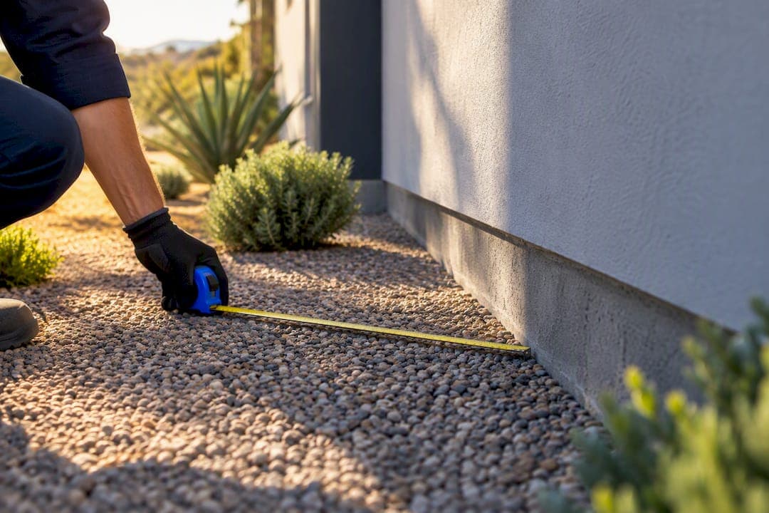
Zone 0 covers the five feet immediately surrounding a structure, and it's the newest, strictest layer of San Diego's fire code. The rule traces back to state law AB 3074, which the City is now enforcing on a phased schedule after a 2025 executive order sped things up.
The City's Zone 0 guidance document spells out what has to go from that five-foot band and what stays. Common items that trip people up:
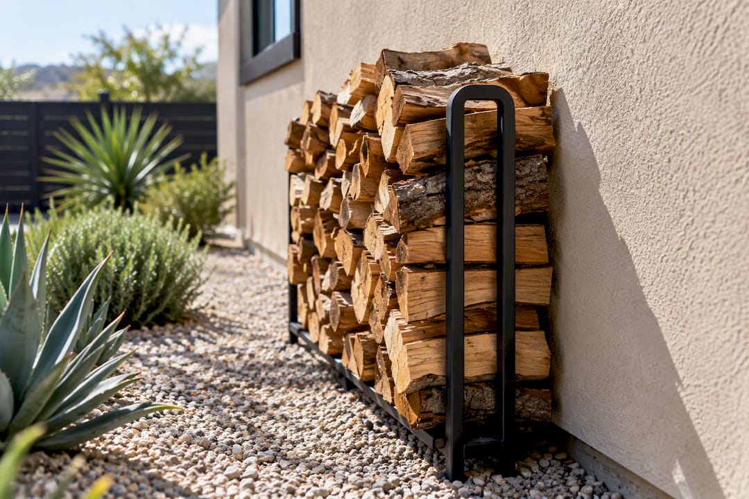
- Stacked firewood or lumber against the house
- Potted plants sitting directly beneath windows or on wood decking
- Combustible patio furniture, cushions, and umbrellas left permanently in place
- Bark or wood mulch touching the foundation
New construction has to meet Zone 0 standards now. Existing homes get a longer runway, with compliance phased in through 2029, giving owners time to swap materials and rethink landscaping without a sudden, expensive scramble.
Pro Tip: Photograph your Zone 0 area before and after any cleanup, and keep the images with your home file. Insurers and permit reviewers increasingly ask for dated proof, not just a verbal assurance that the work got done.
What Fire-Zone Status Means for Owners, Sellers, and Buyers
If your parcel sits in a High or Very High zone, defensible space isn't optional. Public Resources Code 4291 requires vegetation clearance around structures, and the Fire Safe Council of San Diego County recommends pairing that clearance with ignition-resistant building materials for real protection.
Selling changes the equation further. A Defensible Space Inspection, required under Civil Code 1102.19(a) for properties in these zones, has to be disclosed to buyers. The updated map and Zone 0 rules can also trigger new permit conditions on remodels or additions that wouldn't have applied a few years ago.
A short checklist for owners in these zones:
- Clear roof and gutters of leaf litter and pine needles at least twice a year.
- Keep the 0 to 5 foot band around the structure free of combustible material year round.
- Schedule your Defensible Space Inspection well before listing, not after an offer is accepted.
- Call San Diego Fire-Rescue's Community Risk Reduction division with any question about your specific parcel.
How Updated Fire Zones Affect Real Estate Deals
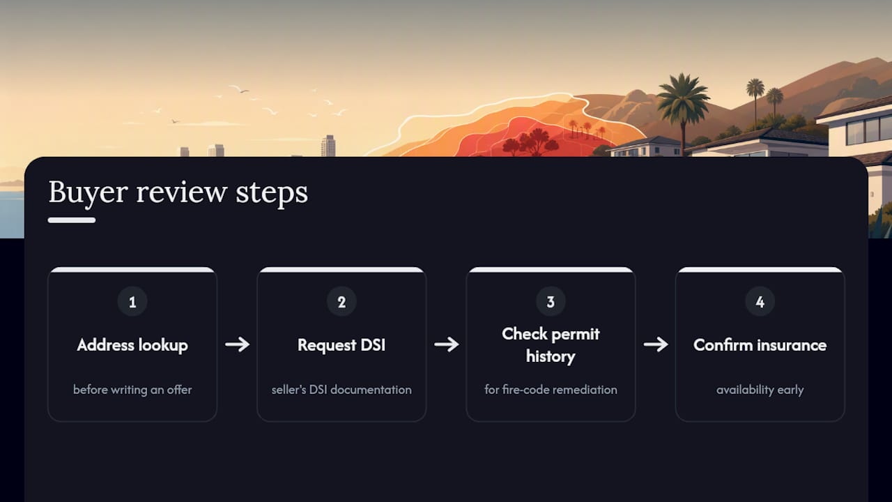
Buyers shopping in canyon-adjacent or eastern neighborhoods should run the address lookup before writing an offer, then request the seller's DSI documentation and check the permit history for any fire-code remediation already completed. Insurance availability is worth confirming early too, since some carriers have pulled back in the highest risk tiers.
Sellers benefit from ordering the DSI at listing rather than waiting for it to become a closing bottleneck. Fixing an obvious hazard, like firewood stacked against a wall, costs far less than renegotiating price after an inspector flags it mid escrow. A local agent who already knows the defensible-space expectations in canyon communities can keep the DSI, permit review, and Fire-Rescue coordination moving in parallel instead of stacking them one after another.
Quick Checklist and Who to Contact
Start here:
- Run your address through the City's fire-zone map and save the result.
- Read the Zone 0 guidance PDF if your property falls in a High or Very High zone.
- Contact San Diego Fire-Rescue's Community Risk Reduction team for parcel-specific questions.
- Check with Development Services before pulling permits on any exterior remodel.
- Look into defensible-space funding programs through the Fire Safe Council if remediation costs are a concern.
Why Checking Your Exact Address Still Matters Most
Fire risk in San Diego doesn't respect neighborhood lines. I've seen two homes on the same cul de sac land in different zones because one backs up to a brush canyon and the other doesn't. The map is where you start, but it can't tell you what's actually growing against your fence line or whether your deck qualifies as ember-resistant.
When I work with buyers or sellers on a property in one of these zones, the map check and the DSI paperwork happen early, not as an afterthought before closing. That's the difference between a smooth escrow and a renegotiation nobody saw coming.
— Jeff
Get Local Help Navigating San Diego's Fire Zone Rules
A local real estate agent familiar with San Diego can help navigate fire-zone paperwork, understand which canyon-adjacent streets typically require a Defensible Space Inspection, and coordinate that inspection with Fire-Rescue and Development Services to avoid closing delays.

If you're buying in a High or Very High zone, Buy With Confidence walks you through the address lookup, insurance questions, and permit history before you make an offer. Selling a property in one of these zones? Sell With Strategy covers ordering the DSI early and getting ahead of remediation issues before a buyer's inspector finds them first. Curious what your current fire-zone designation might mean for value? Request a Home Valuation and get a straight answer, not a guess.
Sources
- Local Responsibility Areas (LRA) 2025 Updated FHSZ Map - Effective August 30, 2025 | City of San Diego Official Website
- Zone 0 guidelines for existing structures (City of San Diego)
- Fire Hazard Severity Zones | OSFM - CA.gov
FAQ
How Do I Know if I'm in a High Fire Zone in California?
Search your address in the City of San Diego's fire-zone map viewer or the state's LRA viewer to see your parcel's exact designation. Both tools reflect the 2025 map update and let you zoom to street level for accuracy.
Is San Diego in a Fire Zone?
Yes, San Diego includes Moderate, High, and Very High fire hazard severity zones, concentrated in canyon-adjacent and brush-heavy hillside neighborhoods. Not every property in the city falls into a mapped zone, which is why an address-specific lookup matters more than a general assumption about your neighborhood.
What Is Zone 0 in San Diego?
Zone 0 is the five-foot ember-resistant buffer immediately around a structure, required under state law and detailed in the City's Zone 0 guidance document. New construction must comply now, while existing homes have a phased timeline running through 2029.
What Cities in California Have the Highest Fire Risk?
Risk concentrates in wildland-urban interface communities across the state, and San Diego County rates Extreme on FireRisk.ai's scoring model, with 145 recorded wildfires within 25 miles since 2000. Within the county, canyon-adjacent and eastern hillside areas of San Diego carry the highest designations on the current fire hazard maps.
Can a Real Estate Agent Help With Fire Zone Requirements During a Sale?
Yes, an experienced local agent can coordinate the Defensible Space Inspection, track permit history tied to Zone 0 compliance, and time remediation work around escrow deadlines. Sell With Strategy and Buy With Confidence are built around exactly this kind of local, transaction-focused support.